Road network labeling from satellite imagery
Road labeling traces the road network in an image (as centrelines, road-surface polygons, or both) with a class for each road. It feeds mapping and routing, infrastructure planning and models that extract roads automatically.
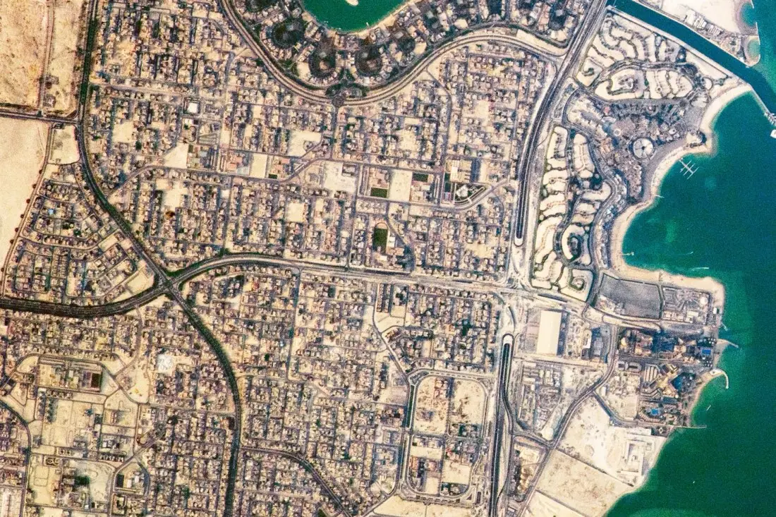
- Highway2 lines
- Arterial road4 lines
What roads labeling is
Roads are thin, often hidden by trees or shadows, and their meaning depends on connections. We trace centrelines that connect at real junctions, so the result can be routed, and class roads by hierarchy: highway, arterial, local, track. Where a road is hidden, we follow it through the gap instead of breaking the network. The example is a district of Doha from the International Space Station.
How we label it
Centrelines are labeled as connected lines with a class; road surfaces as polygons when width matters. Surface type (paved / unpaved) and condition can be added on high-resolution imagery.
Who uses roads labels
Mapping and navigation
Add missing and new roads to base maps.
Infrastructure planning
A current, connected road network for transport and accessibility studies.
Rural access and development
Map unpaved tracks that official maps often leave out.
Road-extraction models
Connected centrelines and surface masks to train segmentation models.
How a project runs
Four steps, each ending in something you can check before the next one starts.
Brief
Area, dates and class list agreed in writing, with example images for every class and its edge cases.
You getWritten labeling guideline
Imagery
Your imagery, or sourced for you: free Sentinel and Landsat, or commercial high-resolution scenes.
You getScene list with dates and resolution
Labeling
Annotators work to the guideline. Anything the imagery cannot settle is flagged, not guessed.
You getLabels plus a log of flagged cases
Check & delivery
Every class is reviewed against a sample before the data leaves us.
You getData and per-class accuracy, in your format and CRS
Questions about roads
Lines or polygons?
Lines (centrelines) for networks and routing; polygons for road area and width. We can deliver both.
Can roads be labeled under trees?
Where the road clearly continues, yes. The hidden stretch is traced and flagged as occluded.
Can you label road condition?
On high-resolution imagery, surface type and visible damage can be classed.
Related label types
Need roads labeled?
Tell us your area, your imagery and what your model has to learn. We reply with a proposed class list and a quote.