Burn scar labeling for forests and land
Burn scar labeling outlines forest and land that has burned and, where needed, how severely. It is used to account for carbon lost to fire, to plan recovery and to train models that map fires automatically.
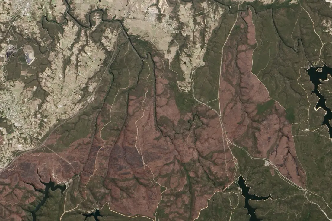
- Burn scar1 polygon
- Lake (excluded)2 polygons
What burn scars labeling is
Fresh burn scars stand out in the shortwave infrared; older ones fade as vegetation regrows, so dating matters. We label each scar on post-fire imagery, compared with a pre-fire image, and keep lakes, shadows and cleared land out of the footprint. Severity, based on the change in burn indices, is added when your model needs it. The example is the Balmoral fire in New South Wales.
How we label it
Scar polygons are labeled with the fire date window. Severity classes (low, moderate, high) are defined against index ranges and visual examples, and checked on high-resolution imagery where available.
Who uses burn scars labels
Forest carbon accounting
Measure fire losses inside carbon projects and national inventories.
Fire-ecology research
Consistent fire histories across years and regions.
Recovery monitoring
A baseline to track regrowth over the following seasons.
Burned-area models
Labeled scars to train and validate automatic burned-area mapping.
How a project runs
Four steps, each ending in something you can check before the next one starts.
Brief
Area, dates and class list agreed in writing, with example images for every class and its edge cases.
You getWritten labeling guideline
Imagery
Your imagery, or sourced for you: free Sentinel and Landsat, or commercial high-resolution scenes.
You getScene list with dates and resolution
Labeling
Annotators work to the guideline. Anything the imagery cannot settle is flagged, not guessed.
You getLabels plus a log of flagged cases
Check & delivery
Every class is reviewed against a sample before the data leaves us.
You getData and per-class accuracy, in your format and CRS
Questions about burn scars
How far back can you label fires?
With the Landsat archive, to the 1980s for most of the world.
Can you label severity?
Yes, as classes based on the change in burn indices between pre- and post-fire images, checked visually.
Do you label smoke?
Smoke and cloud are marked as not observed so they do not distort the footprint.
Related label types
Need burn scars labeled?
Tell us your area, your imagery and what your model has to learn. We reply with a proposed class list and a quote.