Building footprint labeling from satellite imagery
Building footprint labeling draws the outline of every building visible in an image. Footprints are the base layer for cadastre and tax registers, census and population estimates, exposure models and building-detection AI.
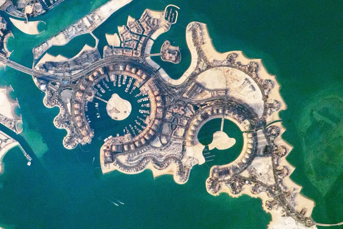
- Building40 boxes
- Marina water2 polygons
- Road1 line
What building footprints labeling is
Footprints need high resolution: at 0.5 m a house is about twenty pixels across. We trace roof outlines, correct for the lean of tall buildings in off-nadir images where your use needs the ground footprint, and split terraces and attached buildings when the roofline shows it. The example is The Pearl-Qatar from the International Space Station: rings of villas around two marinas.
How we label it
Each building is one polygon with right-angled corners where the roof has them. Attributes such as building type or roof material can be added. Small sheds and structures under your minimum size are skipped or labeled as their own class.
Who uses building footprints labels
Cadastre and property tax
Find unregistered buildings and extensions by comparing footprints with the register.
Census and population
Building counts and sizes as a basis for population estimates.
Exposure for insurers
Know what is standing where, for catastrophe and portfolio models.
Building-detection models
Footprint polygons to train and benchmark segmentation models.
How a project runs
Four steps, each ending in something you can check before the next one starts.
Brief
Area, dates and class list agreed in writing, with example images for every class and its edge cases.
You getWritten labeling guideline
Imagery
Your imagery, or sourced for you: free Sentinel and Landsat, or commercial high-resolution scenes.
You getScene list with dates and resolution
Labeling
Annotators work to the guideline. Anything the imagery cannot settle is flagged, not guessed.
You getLabels plus a log of flagged cases
Check & delivery
Every class is reviewed against a sample before the data leaves us.
You getData and per-class accuracy, in your format and CRS
Questions about building footprints
What resolution do building footprints need?
About 0.5 m or better. On Sentinel-2 at 10 m only built-up areas can be mapped, not single buildings.
Can you update an existing footprint layer?
Yes. We add new buildings, remove demolished ones and correct outlines, and report each change.
Do you label building height?
Height bands can be estimated from shadows or added from elevation data, such as lidar.
Related label types
Need building footprints labeled?
Tell us your area, your imagery and what your model has to learn. We reply with a proposed class list and a quote.