Wildfire burn area labeling for insurance
Burn area labeling outlines the land a wildfire burned and, for insurance, the settlements and buildings at or inside its edge. It gives wildfire risk and claims models an observed footprint instead of a reported one.
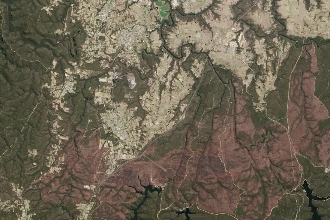
- Burned area1 polygon
- Built-up exposure4 polygons
- Water1 polygon
What burn areas labeling is
Burned land is clear in the shortwave infrared bands of Sentinel-2 and Landsat, even through smoke. We trace the fire perimeter and the unburned islands inside it, then add the exposure layer that matters to an insurer: built-up areas and buildings at the edge or inside the burn. The example is the 2013 Balmoral fire south-west of Sydney.
How we label it
Footprints are labeled on post-fire imagery compared to a pre-fire scene, so cleared land and shadows are not mistaken for burn. Burn severity classes are available when the model needs more than burned / unburned.
Who uses burn areas labels
Claims triage
Identify which policies sit inside or next to a burn before inspection.
Wildfire risk models
Historic footprints at the edge of towns, where losses happen, to train and test risk scores.
Underwriting
Past fire activity around a location as an input to pricing.
Portfolio exposure
Sum insured inside a footprint within days of a fire.
How a project runs
Four steps, each ending in something you can check before the next one starts.
Brief
Area, dates and class list agreed in writing, with example images for every class and its edge cases.
You getWritten labeling guideline
Imagery
Your imagery, or sourced for you: free Sentinel and Landsat, or commercial high-resolution scenes.
You getScene list with dates and resolution
Labeling
Annotators work to the guideline. Anything the imagery cannot settle is flagged, not guessed.
You getLabels plus a log of flagged cases
Check & delivery
Every class is reviewed against a sample before the data leaves us.
You getData and per-class accuracy, in your format and CRS
Questions about burn areas
What is the difference from burn scars?
The same fire, a different question. Burn areas for insurance focus on the footprint against buildings; burn scars for forestry focus on the forest that burned and how it recovers.
How soon after a fire can you label?
As soon as there is a clear post-fire image. Sentinel-2 revisits every few days.
Can you show which buildings burned?
That needs high-resolution imagery. See building damage labeling.
Related label types
Need burn areas labeled?
Tell us your area, your imagery and what your model has to learn. We reply with a proposed class list and a quote.