Canopy loss labeling for EUDR and carbon projects
Canopy loss labeling marks where tree cover existed on a reference date and is gone on a later one. It is the core evidence for deforestation-free claims under the EU Deforestation Regulation (EUDR) and for forest-carbon baselines.
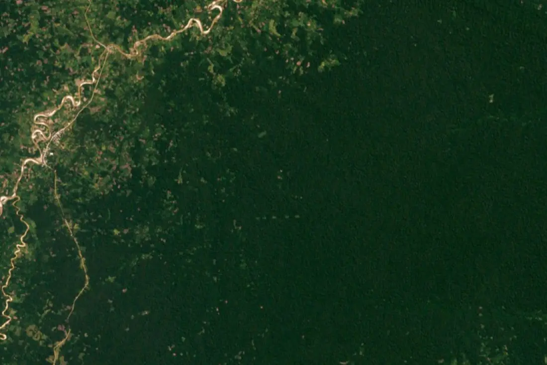
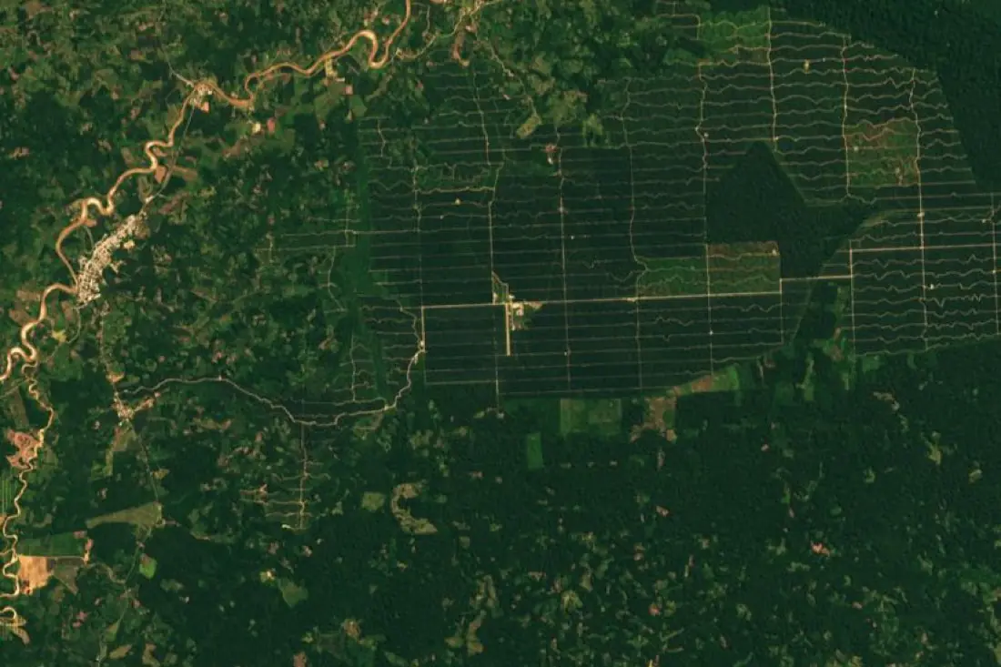
- Canopy loss 2001–20191 polygon
- Small clearings3 polygons
- Forest kept1 polygon
What canopy loss labeling is
EUDR asks whether land was deforested after 31 December 2020; carbon projects ask the same of their own baseline date. Answering it means comparing the forest then and now, plot by plot. We label forest on the reference image, label it again on the recent image, and mark the difference as loss, distinguishing permanent clearing from temporary disturbance where the series allows. The example compares Yurimaguas, Peru, in 2001 and 2019.
How we label it
Loss is labeled against a forest definition agreed in writing (minimum canopy cover, tree height and area), so the result can be defended. Each loss polygon carries the dates between which it occurred.
Who uses canopy loss labels
EUDR due diligence
Evidence that sourcing plots were not deforested after the cutoff date.
Carbon project baselines
Measured loss inside and around a project area for crediting and leakage.
Deforestation alert models
Labeled loss events to train and validate automatic alerts.
Supply-chain screening
Check supplier regions for recent clearing before contracts are signed.
How a project runs
Four steps, each ending in something you can check before the next one starts.
Brief
Area, dates and class list agreed in writing, with example images for every class and its edge cases.
You getWritten labeling guideline
Imagery
Your imagery, or sourced for you: free Sentinel and Landsat, or commercial high-resolution scenes.
You getScene list with dates and resolution
Labeling
Annotators work to the guideline. Anything the imagery cannot settle is flagged, not guessed.
You getLabels plus a log of flagged cases
Check & delivery
Every class is reviewed against a sample before the data leaves us.
You getData and per-class accuracy, in your format and CRS
Questions about canopy loss
Can you check plots against the EUDR cutoff?
Yes. We label forest cover on imagery from around 31 December 2020 and compare it with a recent image for each plot.
Is Sentinel-2 enough for EUDR?
For most plots, yes. For very small plots or smallholder agroforestry, high-resolution imagery makes the decision more defensible.
What about plantations?
Tree plantations are labeled as their own class, since clearing natural forest for a plantation is still deforestation under most definitions.
Related label types
Need canopy loss labeled?
Tell us your area, your imagery and what your model has to learn. We reply with a proposed class list and a quote.