Change detection labeling: before and after imagery
Change detection labeling compares two images of the same place and marks what changed between them, and what it changed into. It is the training data for models that watch large areas and raise an alert only when something new happens.
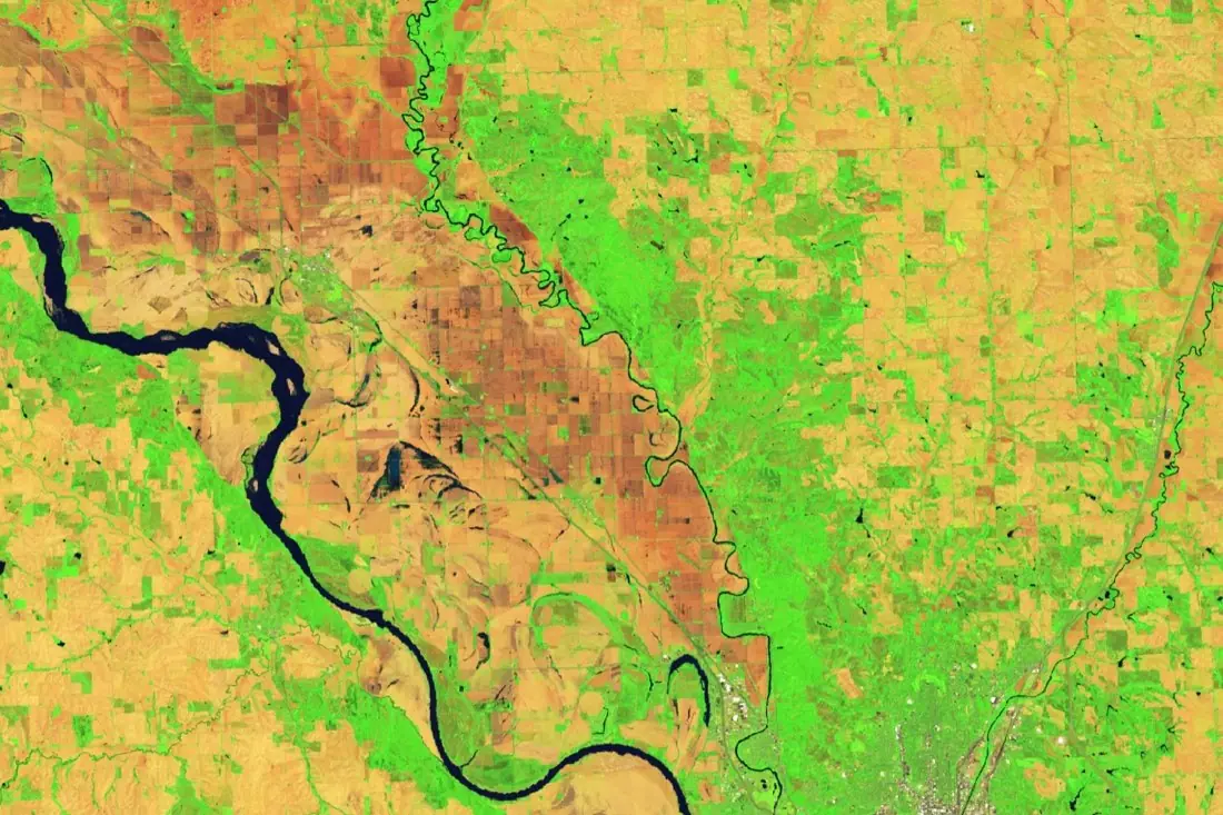
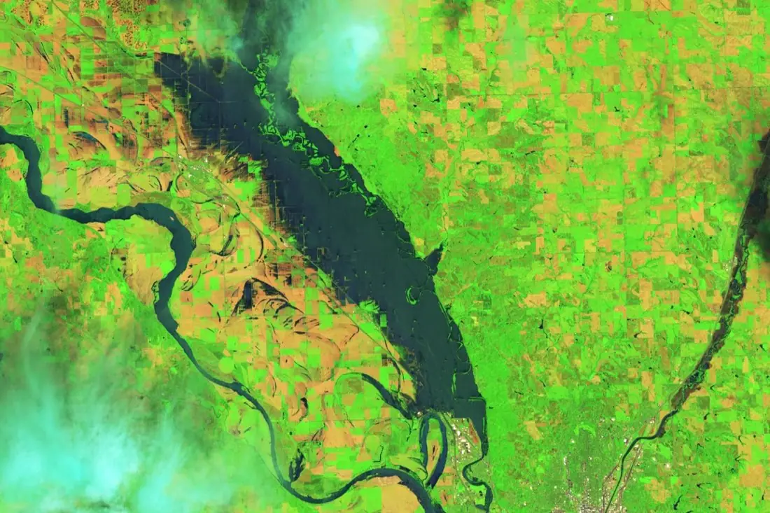
- Change: field → water1 polygon
- Unchanged river1 line
- Not comparable (cloud)2 polygons
What before / after change labeling is
The hard part of change detection is everything that changes but does not matter: seasons, sun angle, clouds, crops being harvested. We co-register the image pair, agree with you which changes count, and label only those. Drag the slider: the left image is Iowa on 9 June 2024, the right one 24 June, after the river broke out.
How we label it
For each pair we label the change polygon with its from-class and to-class (for example field → water) and keep a separate class for areas we could not compare because of cloud or missing data. Unchanged areas are left empty by design.
Who uses before / after change labels
Event monitoring
Train models that flag floods, fires or damage the moment a new image arrives.
Portfolio surveillance
Spot change at insured or financed sites between two policy dates.
Construction and land monitoring
Detect new buildings, clearing or earthworks across a region.
Model validation
A labeled set of real changes, and real non-changes, to measure false alarms.
How a project runs
Four steps, each ending in something you can check before the next one starts.
Brief
Area, dates and class list agreed in writing, with example images for every class and its edge cases.
You getWritten labeling guideline
Imagery
Your imagery, or sourced for you: free Sentinel and Landsat, or commercial high-resolution scenes.
You getScene list with dates and resolution
Labeling
Annotators work to the guideline. Anything the imagery cannot settle is flagged, not guessed.
You getLabels plus a log of flagged cases
Check & delivery
Every class is reviewed against a sample before the data leaves us.
You getData and per-class accuracy, in your format and CRS
Questions about before / after change
How do you avoid labeling seasonal change?
We agree a list of changes that count, with examples, before labeling starts. Crop growth, harvest and shadows are excluded unless your model needs them.
Do the two images need the same sensor?
No, but the same sensor makes labels more reliable. Mixed pairs are labeled at the coarser resolution.
Can you label long time series?
Yes. A change is then dated to the pair of images where it first appears.
Related label types
Need before / after change labeled?
Tell us your area, your imagery and what your model has to learn. We reply with a proposed class list and a quote.